Subject: Cartagena, Colombia
Period: 1743 (circa)
Publication:
Color: Hand Color
Size:
11.1 x 9.1 inches
28.2 x 23.1 cm
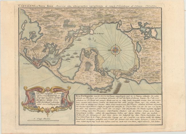
This is a reduced-version of Pierre Chassereau's seminal plan of Cartagena (1740) depicting the Raid on Cartagena in 1697. As part of the War of the Grand Alliance, a small fleet of French ships commanded by Bernard Desjean, Baron de Pointis, attacked the important port city, successfully defeating the Spanish. This delicately engraved map, with north oriented to the left, depicts the French and Spanish ships, the forts protecting the city, and the roads between the forts. To the east of Cartagena is the famous Convento La Popa, high atop a hilltop overlooking the city. A block of text gives a brief summary of the history of Cartagena from its settlement in 1532 to its conquest by the French in 1697. A handsome rococo cartouche completes the composition. A rare and highly desirable map of Cartagena.
References: Kapp (MCC-77) #78.
Condition: A
Sturdy paper with very minor marginal soiling.