Catalog Archive
Auction 164, Lot 380

"Karte des Mexicanischen Meerbusens und der Anstossenden Inseln und Laender zu Robertsons Geschichte von America", Kitchin, Thomas

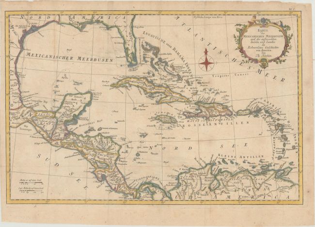
Subject: Gulf of Mexico & Caribbean

Period: 1777 (circa)

Publication: Robertson's Geschichte von Amerika

Color: Hand Color

Size:
18.6 x 12.2 inches
47.2 x 31 cm
Download High Resolution Image
(or just click on image to launch the Zoom viewer)

Lovely copper engraved map covering the region from Florida and the Gulf coast to northern South America. The southern portion of Florida is fragmented into numerous waterways. There is crisp detail of the many islands, the South American coast and Central America. Decorative rococo-style title cartouche and compass rose. This map was published for a German edition of Rev. Dr. Robertson's History of America.

References: Sabin #71998.

Condition: B+

Issued folding, now flattened, on paper with an "IV" watermark, one small hole in Honduras, and light soiling.

Estimate: $230 - $275

Unsold

Closed on 9/13/2017

Archived