Subject: Central Virginia
Period: 1918 (dated)
Publication:
Color:
Size:
21 x 17 inches
53.3 x 43.2 cm
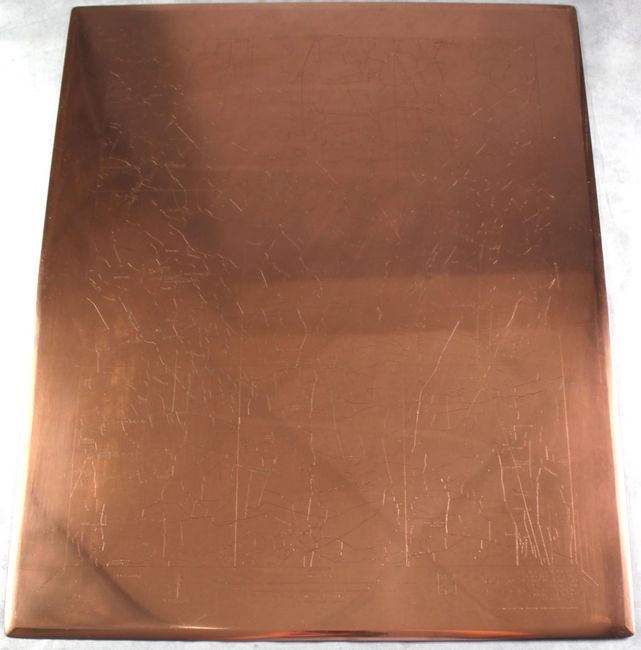
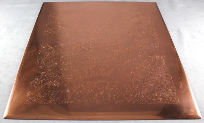
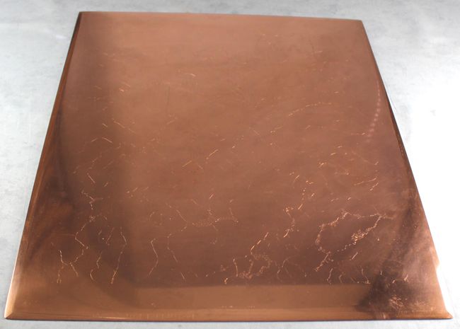
This is a rare offering of the three master copperplates from the first detailed USGS topographic mapping survey of the Doswell, Virginia area performed in 1918. Copperplate engraving was utilized by the USGS from 1885-1942 and resulted in maps with a consistent look and feel. According to Hugh Phillips, author of Copperplate Engraving for the Production of Topographic Maps at the USGS (1997), "copper was chosen as a medium because of its size, stability and workability." Phillips continued that "the USGS will probably never again produce new maps that display artistry equal to the hand engraved copperplate map."
Each USGS map produced during this period required three separate copperplates, with each plate producing a single color and representing the following:
Plate 1: Culture, projection lines, scale and other details (black)
Plate 2: Topography (brown)
Plate 3: Hydrography (blue)
These three master plates were used for the production of all USGS Doswell, VA 15 minute topographic maps printed from 1918 (first edition) to at least 1942 and are entirely unique. Each plate measures approximately 21x17" with 1/16" thickness and weighs approximately 13 pounds (39 pounds in total).
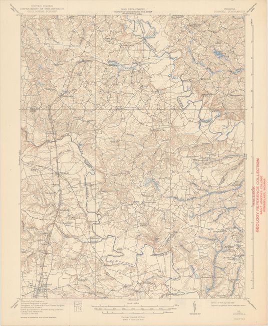
Included with this lot is the 1942 edition paper map from these plates (dated 1918 but updated to 1942). The map covers eastern Hanover, western King William, and southern Caroline counties. It was drawn on a scale of 1 inch per mile with 20 foot contour intervals. Produced under the direction of R.B. Marshall, Chief Geographer.
Provenance: The copper plates were in the possession of the USGS from their creation in 1918 until 2015, and then the current owner from 2015 to the present.
Shipping: The plates and map will be carefully packed in a custom heavy duty box for safe delivery and will be fully insured. Call or email us for a quote.
References:
Condition: A
<u>Copper Plates</u>: Old soiling, lacquer and tarnish on the engraved surface side have been preliminarily removed by careful cleaning. The newly restored surface was then brushed with a layer of Permalac lacquer, also specially formulated for copper, for surface protection. The non-engraved back side of the plate was solvent cleaned and wiped to remove any loose dust and soil but the original tarnish was left intact and uncoated. The engraved lines and letters were left "naked," meaning that no infilling substance was used to highlight these features prior to lacquer coating. These actions were taken to exhibit the natural beauty of the engraved copper surface. <b>The final result is that these plates look nearly brand new with incredible shine, clearly revealing the engraved lines.</b><br><br>
<u>Map</u>: Clean, bright, and near fine with an old library stamp in the right margin not affecting the image with another stamp on verso.