Subject: Boston, Massachusetts
Period: 1907 (dated)
Publication:
Color: Printed Color
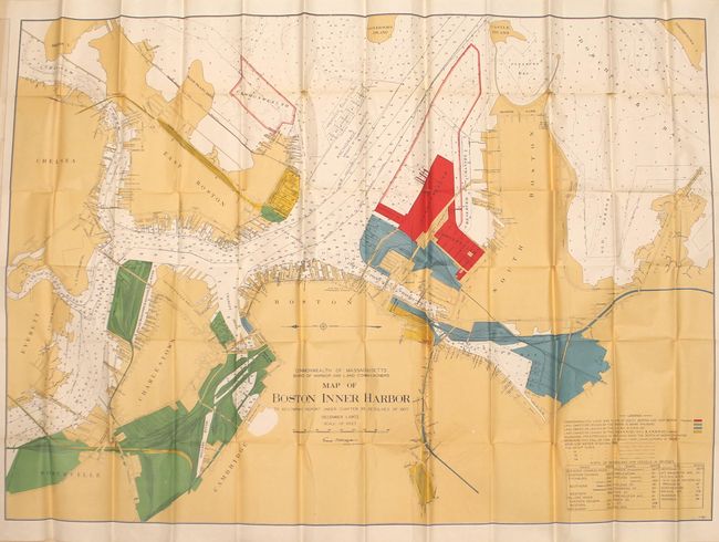
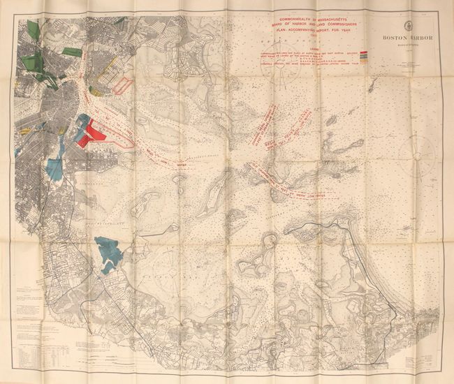
These two very large maps detail Boston Harbor at the turn of the 20th century. Each is color-coded to show ownership along the harbor including land belonging to the state and several railroads. Details include docks, piers, soundings, channels and more. The second map extends to Nantasket in the southeast and shows several channels in red overprinting that were to be dredged. Both maps were issued by the Board of Harbor and Land Commissioners Office.
A. Map of Boston Inner Harbor to Accompany Report Under Chapter 93, Resolves of 1907, dated 1907 (56.5 x 39.1").
B. Boston Harbor Massachusetts, by U.S. Coast & Geodetic Survey, dated 1907 (43.5 x 35.1").
References:
Condition: B+
Both maps are clean and bright with numerous splits at fold intersections as is common for maps of this size. Issued folding.