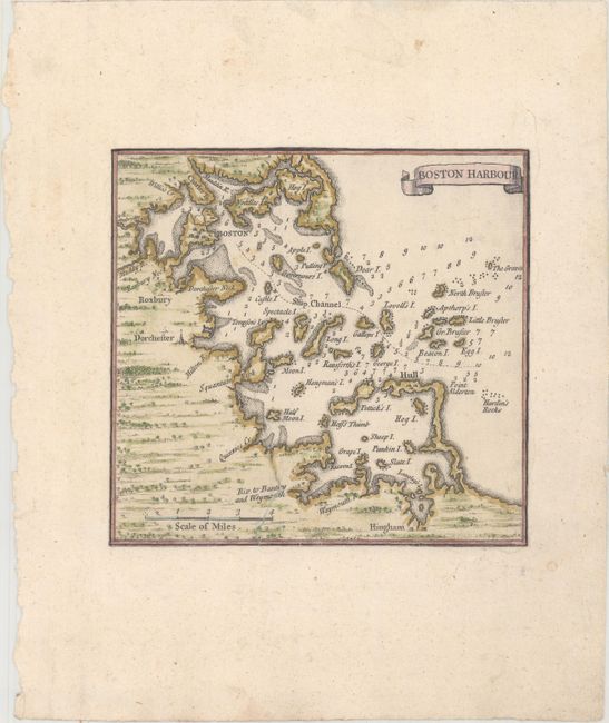
Subject: Boston, Massachusetts
Period: 1733 (circa)
Publication: A Map of the British Empire in America...
Color: Hand Color
Size:
6.1 x 5.8 inches
15.5 x 14.7 cm
This is an inset map of Boston Harbor from sheet number 8 from Henry Popple's famous and scarce 20-sheet map of the British Empire in America, the very first large-scale map of North America. The map includes numerous place names and soundings, and extends south to Hingham. The inset has been trimmed from the original sheet and pasted on period-correct paper.
References:
Condition: B+
A nice impression with a couple of minor spots and a 2" tear at bottom center that has been professionally repaired. The map has been trimmed to the neatlines and pasted onto period-correct paper. There is a tear in the bottom blank margin that has been closed on verso with archival tape.