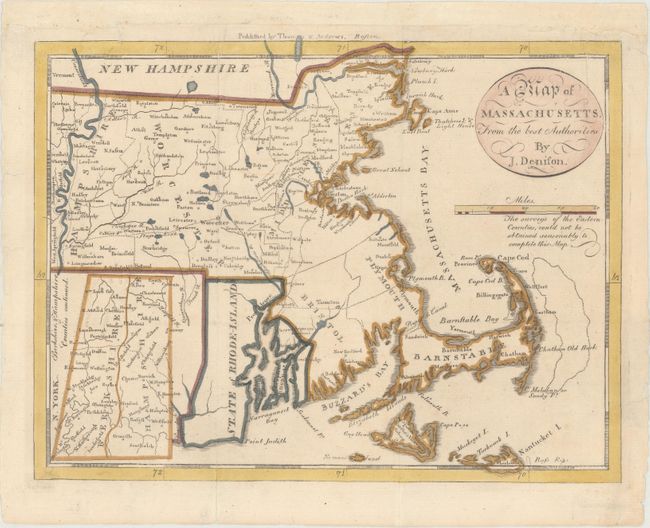
Subject: Massachusetts
Period: 1796 (circa)
Publication: The American Universal Geography
Color: Hand Color
Size:
9.8 x 7.5 inches
24.9 x 19.1 cm
This scarce edition is from the third edition of Morse's Geography. The counties are named and delineated, and the bank offshore from Cape Cod is located. The western counties of Hampshire and Berkshire are continued in an inset at lower left. The map also shows towns, roads, topography, and good watershed detail. The Proposed Canal is located near Sandwich. Beneath the oval title cartouche and distance scale is the note "The surveys of the Eastern Counties, could not be obtained reasonably to complete this Map." As a result the counties of Bristol, Plymouth, and Barnstable are mostly blank. The imprint of publishers Thomas & Andrews runs across the top above the neatline. Drawn by James Denison and engraved by Samuel Hill.
References: McCorkle (18th C. Geography Books) #304-5; Wheat & Brun #218.
Condition: A
Issued folding, now flattened, with a few tiny edge tears that have been archivally repaired. The top margin has been extended with period-correct paper to accommodate framing.