Subject: Maine
Period: 1802-27 (circa)
Publication:
Color:
Size:
7.9 x 11.9 inches
20.1 x 30.2 cm
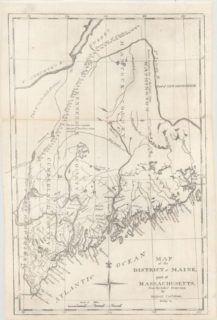
A. Map of the District of Maine, Part of Massachusetts, from the Latest Surveys, by Osgood Carleton, by (Rev.) Jedidiah Morse, from The American Universal Geography, published 1802, black & white (7.9 x 11.9"). This early nineteenth century map is based on Osgood Carleton's important map of the region and was published by Jedidiah Morse, one of the founders of American cartography. It provides early information on the region, which at the time was a part of Massachusetts, and is divided into five counties. A line of mountains mark the boundary between Maine and Canada. This is the second map of Maine that Morse used in his important geography, engraved by Enoch G. Gridley. From the 4th edition of Morses' Geography published in Boston by Thomas & Andrews. Condition: Issued folding with a few tiny fold separations along the sheet edges that have been archivally repaired on verso. (A)
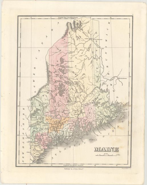
B. Maine, by Anthony Finley, circa 1827, hand color (8.4 x 11.1"). Attractive map of the state that details the roads, towns, and settlements of the day. County configuration pre-dates the addition of Waldo County from Hancock, Lincoln, Kennebec, and Penobscot in 1827. Engraved by Young & Delleker. Finley published his atlases annually between 1824-1834, with one final edition appearing in 1836 (Ristow states his last atlas was 1834). Ref: Phillips (Atlases) #752-7; Ristow pp 268-70. Condition: Some light spots at bottom right and binding holes in the left blank margin. (B+)
References:
Condition:
See description above.