Subject: Florida
Period: 1851 (dated)
Publication:
Color: Black & White
Size:
25.3 x 22.2 inches
64.3 x 56.4 cm
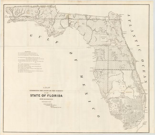
This 1851 edition shows up-to-date survey progress and development in the state. The map shows the entire state to include Key Largo and features the Forbes Purchase and the Arredondo Grant lands. Numerous forts are located including Lauderdale, Howell, Foster, Thompson, Adams, and many more. This map was produced during a period of relative peace between the U.S. and Seminole Nation. The third and final Seminole War waged between 1855-1858. Extensive legend gives survey status for townships. From the Surveyor General's Office in St. Augustine, by B.A. Putnam, Surveyor General.
References:
Condition: A
Issued folding on a clean sheet with very faint offsetting of the title and a few tiny splits at fold intersections.