Catalog Archive
Auction 164, Lot 260

"Florida Nach den Besten Quellen Bearbeitet", Meyer, Joseph
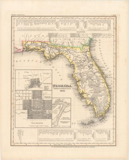
Subject: Florida

Period: 1845 (dated)

Publication: Meyer's Handatlas

Color: Hand Color

Size:
11.8 x 14.6 inches
30 x 37.1 cm
Download High Resolution Image
(or just click on image to launch the Zoom viewer)

This is an interesting map of the state of Florida based on the important Mitchell series showing towns, forts, roads, canals, major rivers and lakes. There are three inset maps detailing Pensacola, Tallahassee, and St. Augustine. The map reflects the configuration of counties in 1835 prior to the organization of Dade County. Water routes from St. Augustine and Pensacola to various ports are described above and below the map.

References:

Condition: A

Original outline color with a few faint spots of foxing primarily confined to the blank margins and light toning just outside the neatline at right.

Estimate: $240 - $300

Sold for: $150

Closed on 9/13/2017

Archived