Subject: Colorado
Period: 1861 (dated)
Publication: Sen. Ex. Doc. No. 1 37th Cong. 2nd Sess.
Color: Black & White
Size:
20.8 x 17.8 inches
52.8 x 45.2 cm
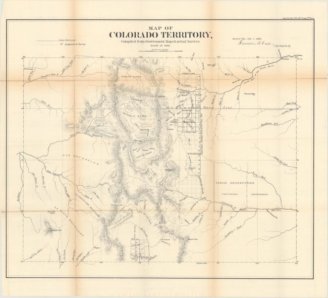
This is the first official map of Colorado. It is signed in the plate "Denver City Nov. 1st 1861. Francis M. Case Sur. Genl. Co. Ty." The map has good detail considering this early attempt at mapping the territory. Details include watershed, mountains in hachure, and survey status shown along the plains just east of the Front Range. The towns of Denver, Colorado City (Colorado Springs), Boulder City, Golden City, Pueblo, Canon City, Breckenridge, Central City, Ft. St. Vrain are shown. Mountains named include Pike's Peak, Longs Peak, Spanish Peaks, etc. The map is centered on the San Luis Valley and the parks - South, Middle and North. In the plains is the Indian Reservation divided between the Cheyennes and Arapahoes. An important map that should be in any collection of Colorado maps.
References: Wheat (TMW) #1034.
Condition: B
Issued folding with light toning along the folds and a few tiny splits at fold intersections.