Subject: Northern California
Period: 1850 (published)
Publication: Sen. Doc #47, 31st Cong., 1st Sess.
Color: Black & White
Size:
14.8 x 11.7 inches
37.6 x 29.7 cm
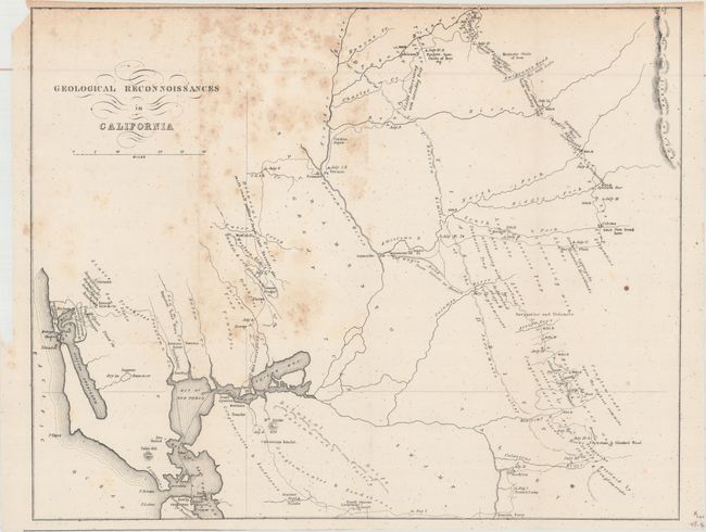
This California Gold Rush map shows the area from San Francisco Bay north and east to the Yuba River and east to the Calaveras River. Published in Tyson's Report upon the Geology and Topography of California, the map traces his route from San Francisco by way of Vernon to the Yuba diggings, then south passed the Emigrant's Road to the Salt Lake, through the gold region to the Calaveras River, and west through Bonsal's Ferry, Livernore’s Ranch and Martinez. It notes dates of his encampments, geological types, and the points where gold was being mined. According to Wheat, Tyson's work was "probably the earliest work of a true scientific research to emerge from the Gold Rush."
References: Wheat (Gold) #179.
Condition: B
Issued folding with scattered foxing mostly at top.