Subject: Northwestern United States
Period: 1867 (dated)
Publication:
Color: Hand Color
Size:
13.5 x 10.9 inches
34.3 x 27.7 cm
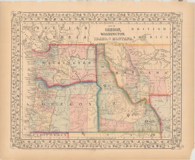
This decorative map features the newly formed, but unnamed Wyoming. In this configuration the northwestern corner extends as a wedge between Idaho and Montana. Both Idaho and Montana show early county development. Eastern Washington is shown with only three counties while Oregon's eastern portion has four. The map notes places so important to navigation, such as Ft. Boise, Ft. Bonneville, the Three Buttes, and several gold mining areas including Elk City. The Emigrant Road, or the Oregon Trail, winds across from South Pass, following the route of the Snake River and ending at The Dalles.
References:
Condition: A
There are a few minor spots in the map image and some toning and edge tears in the blank margins.