Subject: Western United States
Period: 1857 (circa)
Publication: U.S. and Mexican Boundary Survey, Vol. I
Color: Hand Color
Size:
23 x 20 inches
58.4 x 50.8 cm
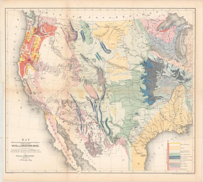
This great map of the western United States was one of the first geological maps of the region. It illustrates the many mineral resources that helped spur westward migration and expansion. The legend uses color to identify eleven geological types. The map is also filled with terrific detail of mountains, watersheds, cities, and roads. It covers the country from the Ohio River Valley to the Pacific and extends to include the states of Sonora and Chihuahua in Mexico. The political divisions include the large western territories of Washington, Oregon, Utah, New Mexico, Nebraska, and Kansas. Drawn by Thomas Jekyll. Lithographed by Sarony, Major & Knapp, 449 Broadway, New York.
References: Marcou & Marcou #52; Wheat (TMW) #922; Blevins Wyoming #76.
Condition: B+
Issued folding and now flattened and backed with tissue. There is a 4" binding tear at left that has been archivally repaired on verso along with a bit of toning along the left vertical fold.