Subject: Western United States
Period: 1846 (dated)
Publication: Mitchell's School and Family Geography
Color: Hand Color
Size:
7.9 x 10.3 inches
20.1 x 26.2 cm
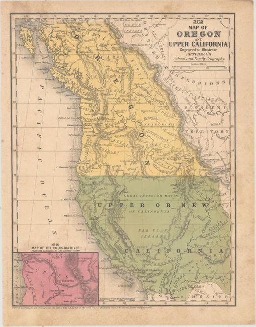
This is the smaller school atlas version of Mitchell's well-known map which is based largely on Fremont's map of 1845. This edition has the US/Canadian boundary as we know it today with the notation "Boundary of 1846." Upper California extends eastward to the Rio Grande and Oregon Territory to the Continental Divide. The map delineates the Oregon Route (Oregon Trail) in good detail as it winds from the Sweetwater River through South Pass to Oregon City. Numerous Indian tribes and villages and forts are located. An early depiction of the Great Basin is here called the Great Interior Basin of California. At lower left is the inset "Map of the Columbia River from the Cascades to the Pacific Ocean" which locates Oregon City, Ft. Vancouver, a mission on the Columbia, Mt. Hood, and Mt. St. Helens with a height of 13,300 feet.
References: Wheat (TMW) #518; Wheat (Gold) #28.
Condition: B+
Original color with light toning and scattered foxing.