Subject: World
Period: 1730 (circa)
Publication:
Color: Hand Color
Size:
18.6 x 15.8 inches
47.2 x 40.1 cm
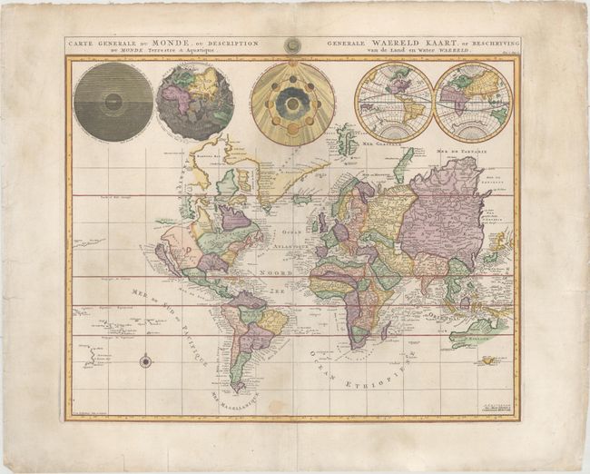
This is Pierre Mortier's unique world map drawn on Mercator's projection. It depicts California as an island and the Detroit d'Anian connected by dotted lines through the Northwest Passage to Button's Bay located to the west of Hudson Bay. There is an erroneous large lake shown as the source for the Rio Norte (Rio Grande River) located in the Southwest, as well as an early, open-ended version of the Great Lakes named Mer Douce. A small coastline of New Zealand appears in the Pacific. The northeast coast of Asia is severely truncated and shows Witsen's Cap de Glaces. Australia's northern coast is shown connected to New Guinea, and two disjointed coastlines appear to the south, including Van Diemen's Land. The most interesting features of the map are the five spheres presented along the top depicting day and night, the flood, the phases of the moon, and the Western and Eastern Hemispheres. The map was precisely engraved by Jan van Luchenburg (imprint at lower left). This is the second state with the Covens and Mortier imprint.
References: Shirley #622.
Condition: B+
There is light soiling and a small stain in an unengraved area at bottom. Several edge tears in the blank margins have been repaired with archival materials on verso.