Subject: Central United States
Period: 1856 (published)
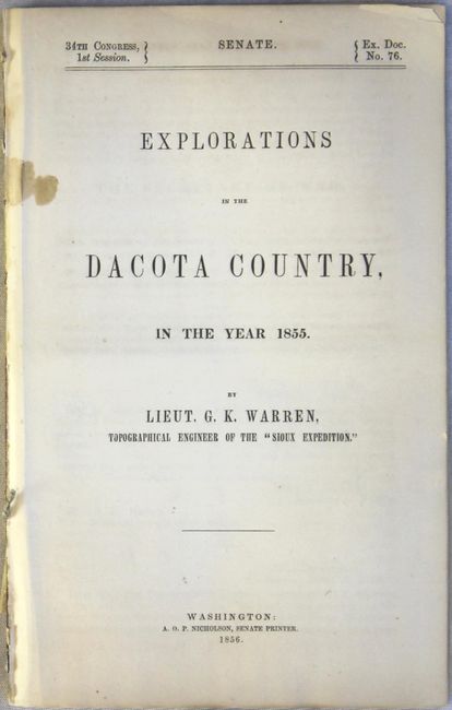
Publication: Sen. Ex. Doc. No. 76, 34th Congress, 1st Session
Color: Black & White
Size:
5.7 x 9 inches
14.5 x 22.9 cm
Lieutenant G.K. Warren served as topographic engineer on the "Sioux Expedition" under the command of General William S. Harvey, who was sent to "chastise the Sioux for the killing of Lt. John L. Grattan and his command of twenty-nine men in the summer of 1853." Also providing a geological report but not actually accompanying the expedition was F. V. Hayden, better known to the Indians from an earlier explorations as "Man Who Picks Up Stones Running" for his peculiar habit of gathering rock samples alone in hostile country (they thought he was crazy). The maps included in the report are:
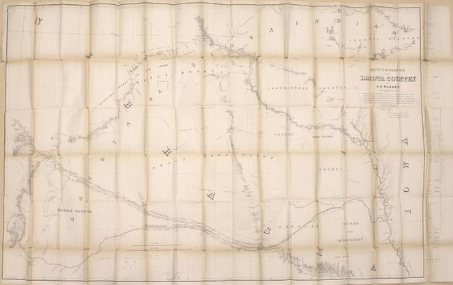
Reconnoissances in the Dacota Country (56 x 36"). This large map was printed on two sheets and joined. It covers the region from Omaha north to Fort Ridgley (MN) and west to Fort Laramie (WY). Shows the path of Warren's exploration throughout the region with encampment dates noted. Also depicts previous explorers routes including Long, Fremont, Stansbury and Nicollet. Presents good detail of topography, the river systems, and the location of numerous Indian tribes and reserves.
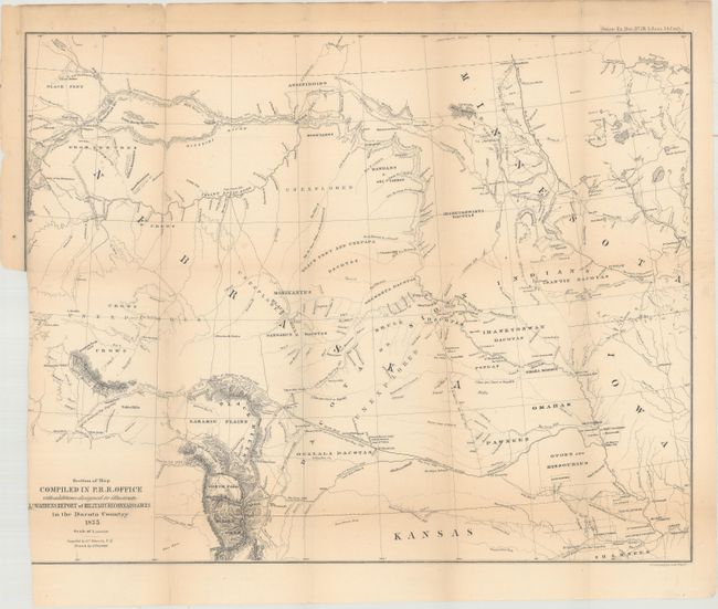
Section of Map Compiled in P. R. R. Office with Additions Designed to Illustrate Lt. Warren's Report of Military Reconnaissances in the Dacota Country (17 x 15"). A reduced version of the above map that extends further north to the Canadian border showing Governor Stevens' route among others.
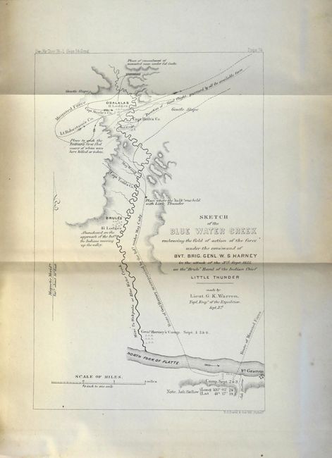
Sketch of Blue Water Creek Embracing the Field of Action... (5.5 x 8.6"). This small map shows the region near present-day Ash Hollow, the site of one of the first major battles in the Indian Wars. It shows the camp of the Brule band of the Ogallala Sioux, led by Chief Little Thunder, and their flight from the army of 600 soldiers led by Col. William. S. Harney. Detailed movements are shown for the infantry and cavalry.
First edition, octavo, 79, [1], vi, pages plus the 3 folding maps. Disbound and housed in an attractive blue clamshell case with gilt title on spine and front cover.
References: Howes #W118; Wagner-Camp #283; Wheat (TMW) #871.
Condition: B
The large folding map has light toning and numerous splits at fold intersections with only minor loss at the junctions. The medium-sized folding map has light toning and a binding trim at lower left that has been cut to just inside the neatline. Disbound text and small map is very good with light toning. Modern cloth case is near fine.