Subject: Central United States
Period: 1836 (circa)
Publication:
Color:
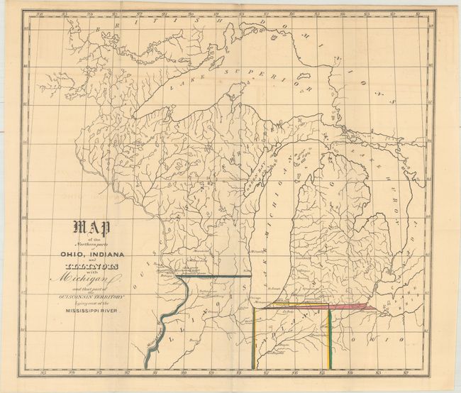
A. Map of the Northern Parts Ohio, Indiana and Illinois with Michigan, and That Part of the Ouisconsin Territory Lying East of the Mississippi River, circa 1836, hand color (14.7 x 13.2"). The boundary line between Michigan and Ohio was a contentious issue - Ohio was blocking admission of Michigan to the Union until the question was settled. The map shows respective claims and also notes Indiana's revised northern boundary. Wisconsin came from the term "Ouisconsin" which is believed to mean "grassy place" in the Cheppewa tongue. Condition: Issued folding with light toning and offsetting. (B+)
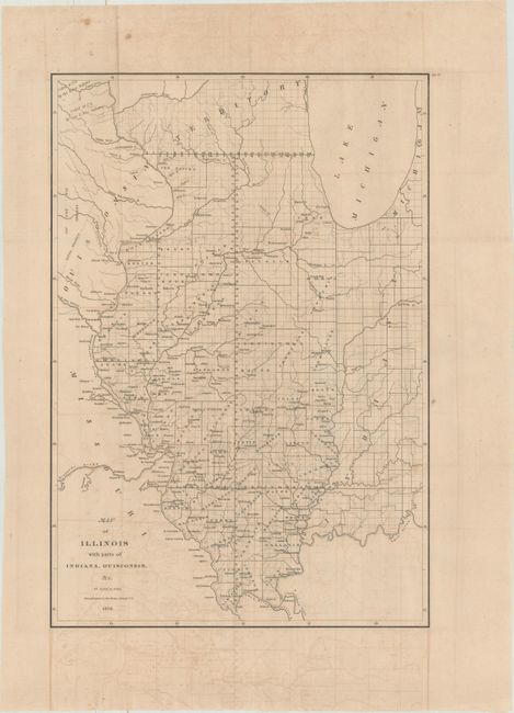
B. Map of Illinois with Parts of Indiana, Ouisconsin, &c., dated 1836, black & white (12.6 x 18.2"). This detailed map provides information on the counties, watershed, settlements, Indian villages and railroads. The proposed routes of the Illinois Central Railroad, Alton and Mount Carmel Railroad, Hillsboro Rail Road, Northern Cross Rail Road, and the Warsaw and Peoria Rail Road are shown. The Indian land boundary and the area ceded to the U.S. by the Sioux, Sac, and Fox nations are noted. Condition: Moderate offsetting. (B)
References:
Condition:
See description above.