Subject: Vermont & New Hampshire
Period: 1802-24 (circa)
Publication:
Color:
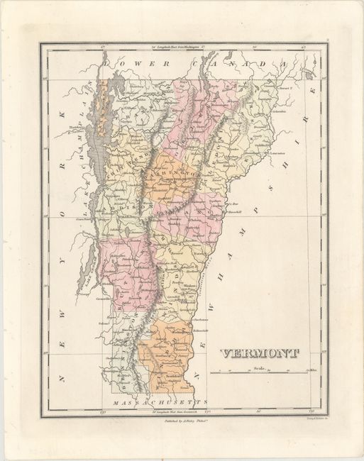
A. Vermont, by Anthony Finley, circa 1824, hand color (8.4 x 10.9"). This terrific, early map of the state shows only 13 counties. The small area that Caledonia County gained from Essex in 1824 is not shown on the map suggesting this is from the first edition (1824). Roads, towns and settlements are detailed. Beautifully engraved by Young & Delleker. Finley published his atlases between 1824 to 1834, with separate issues published in the years 1824, 26, 29, 30, 31, 33, and 34, according to Ristow. Ref: Ristow pp 268-70. Condition: Clean and bright with binding holes confined to the left blank margin. (A)
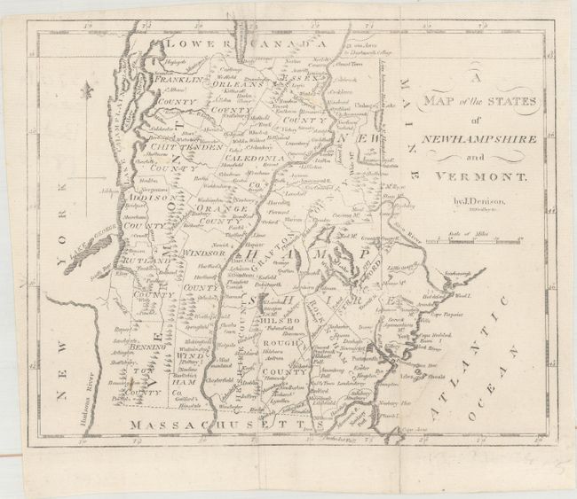
B. A Map of the States of Newhampshire and Vermont, by Rev. Jedidiah Morse, from The American Universal Geography, published 1802, black & white (9.2 x 7.4"). This map was published in the 4th edition of Morse's Geography. It is the first edition to include the boundary line between Maine and New Hampshire. Primarily a topographical map, it nonetheless shows the main roads, county boundaries, and towns. The map delineates five counties in New Hampshire and eleven in Vermont. Drawn by James Denison, engraved by Enoch Gridley (as opposed to Amos Doolittle, who engraved earlier editions), and published from Boston by Thomas & Andrews. Ref: cf. Wheat & Brun #188. Condition: Issued folding, now flat, with a couple fold separations that have been professionally repaired with archival materials on verso. (B+)
References:
Condition:
See description above.