Subject: Eastern United States
Period: 1800 (circa)
Publication:
Color: Black & White
Size:
6.8 x 9.8 inches
17.3 x 24.9 cm
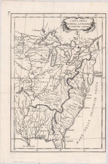
This unusual and uncommon Italian map shows the eastern United States and the Great Lakes. Many rivers, forts, and Indian lands are shown, as are a handful of towns and cities, including Filadelfia, New York, and Savanah. The Appalachian Mountains are prominent and seem to serve as the boundary between the United States (Provincie Unite) and western lands. An oversized Florida appears between the Appalachians and the Louisiana territory (Luigiana) west of the Mississippi. A decorative title cartouche appears in unengraved Canada.
References:
Condition: A
A dark impression issued folding with a narrow right margin due to binding and a 0.5" binding tear closed on verso with archival material.