Subject: World
Period: 1700 (published)
Publication: Algemeene Weereldbeschryving
Color: Hand Color
Size:
12.1 x 8 inches
30.7 x 20.3 cm
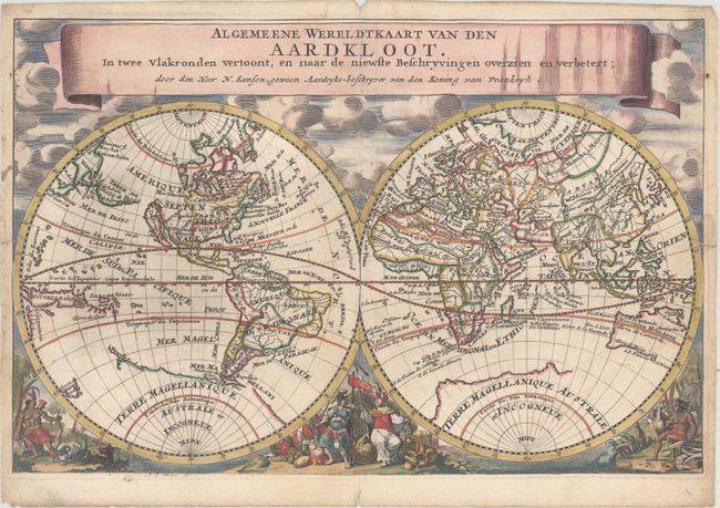
This double hemisphere map is beautifully decorated with clouds at top and allegorical representations of the continents at bottom. California is shown as an island, and Terre de Iesso stretches between Asia and North America. There is a bit of Nouvelle Zeelande that connects to the coastline of the mythical Terre Magellanique, and Australia is only partly mapped. The cartography is based on Nicolas Sanson, who is credited in the title, and engraved by Anthony d'Winter. It was published in the Dutch version of Jans Luyts' geography, published by Francis Halma.
References: Shirley #553.
Condition: B+
There are two edge tears that just pass the neatline at left and right that have been closed on verso with archival tape. Two very faint dampstains are confined to the title banner and along with minor marginal soiling.