Subject: United States
Period: 1860 (dated)
Publication: Sen. Ex. Doc. No. 52, 1st Sess. 36th Cong.
Color: Hand Color
Size:
19.7 x 13 inches
50 x 33 cm
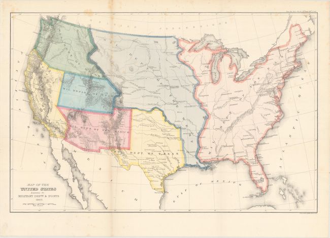
An uncommon and very interesting map that shows seven military districts with full hand coloring. The map has rudimentary watershed and topographical detail, but locates scores of forts and major cities and towns. As such it gives a graphic and detailed picture of the U.S. defenses in the Western frontier. Arizona and New Mexico are shown as one military district, and the Oregon district includes Idaho, Washington and Oregon.. The Military District of the West includes the majority of the Midwest and Rocky Mountain states, including, to mention a few, the present states of the Missouri, Kansas, the Dakotas, Wyoming, Montana, and part of Colorado. The Utah district spans from California to all of Colorado west of the Continental Divide. The East district includes all states east of the Mississippi River. The source map was larger and originally drawn by Burr, the 'Geographer and Draftsman to the Senate' from 1855 to 1859, but this edition carries no attribution. Not in Wheat (TMW).
References:
Condition: B+
Issued folding with faint scattered foxing.