Catalog Archive
Auction 164, Lot 126

Rare Map Showing the State of Franklin

"Kaart van Noord-Amerika, van den 50ften Graad Breedte tot aan den Keerkring van den Kreeft, Volgens de Nieuwste Ontdekkingen", Zimmerman, Eberhard A.W.

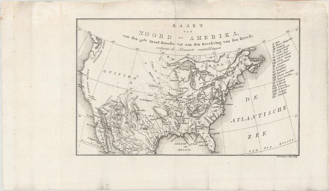
Subject: United States, Franklin

Period: 1818 (published)

Publication: De Aarde en Hare Bewoners, Volgens de Nieuwste Ontdekkingen...

Color: Black & White

Size:
10.6 x 6.5 inches
26.9 x 16.5 cm
Download High Resolution Image
(or just click on image to launch the Zoom viewer)

This small map was published in the Dutch edition of Zimmerman's Taschenbuch der Reisen, oder Unterhaltende Darstellung der Entdeckungen des 18ten Jahrhunderts. This was the fourth title in Zimmerman's annual compliations, and is devoted entirely to America. The map itself covers the entire present-day United States and lists twenty states in a table at right including the short-lived state of Franklin, which is erroneously identified in present-day Ohio. Topography and drainage is emphasized in this map with only a few place names west of the Missouri River including a large Quivira in the Great Basin and New Albion along the west coast.

References: cf. Dotson & Baker (Old World Auctions - State of Franklin Maps) #21.

Condition: A

Issued folding on a watermarked sheet, now flattened and backed in archival tissue, with some small chips and tears confined to the blank margins that have been archivally repaired.

Estimate: $200 - $240

Sold for: $250

Closed on 9/13/2017

Archived