Subject: Colonial Eastern United States
Period: 1720 (circa)
Publication:
Color: Black & White
Size:
9.1 x 10.3 inches
23.1 x 26.2 cm
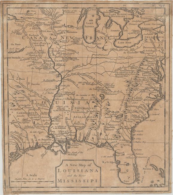
This interesting map focuses on the French empire in the heart of North America, embracing both the Great Lakes and the Mississippi Valley. It illustrates the French threat to the British colonies that are confined along the Atlantic seaboard by the Appalachian Mountains. French trading posts, lead mines, trails, and Indian villages are carefully noted and the Indian nations are prominently named. The Missouri River emanates from a great lake in the northwest that disappears off the map and another Great River flows west from Lack Pani; both alluding to the possibility of a passage to the Pacific.
This is the rare first edition of this map, which appeared in Dr. James Smith's pamphlet, Some Considerations on the French Settling Colonies on the Mississippi [1720]. It was later re-engraved for The Memoirs and Secret Negotiations of John Ker published by Edmund Curll in 1726.
References: Cumming (SE) #176.
Condition: B
Moderate toning, light soiling, and a few extraneous crease. Trimmed close to the neatlines and backed in linen. There are a couple of minor pencil notations and old paper repairs on recto within the map border.