Catalog Archive
Auction 163, Lot 82

"Carte des Etats-Unis d'Amerique", Thierry

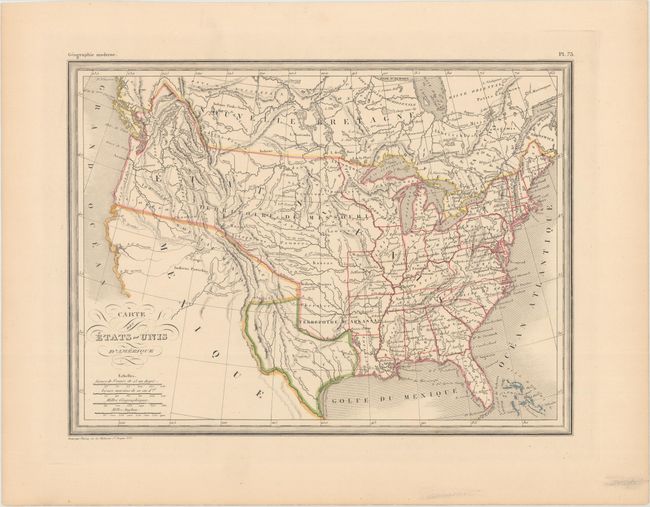
Subject: United States, Texas

Period: 1842 (circa)

Publication: Geographie Moderne

Color: Hand Color

Size:
11.8 x 8.8 inches
30 x 22.4 cm
Download High Resolution Image
(or just click on image to launch the Zoom viewer)

This attractive map of the United States prominently features an independent Republic of Texas. Missouri and Arkansas form the western frontier, and a huge Missouri Territory takes up all lands to their west. In the Pacific Northwest, the boundary with Canada extends well into present-day British Columbia, reflecting United States' interests in the region. In the Great Basin, two spurious rivers connect L. Timpanogos and L. Teguayo to the Pacific Ocean.

References:

Condition: A

Original outline color on a clean sheet.

Estimate: $150 - $180

Sold for: $110

Closed on 6/14/2017

Archived