Catalog Archive
Auction 163, Lot 69

"United States [on sheet with] New Brunswick, Nova Scotia &c.", Smith & Son

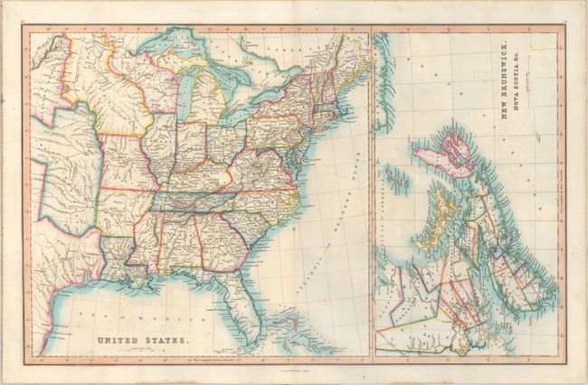
Subject: Eastern United States & Canada

Period: 1846 (circa)

Publication: Smith’s General Atlas...

Color: Hand Color

Size:
22.5 x 14.1 inches
57.2 x 35.8 cm
Download High Resolution Image
(or just click on image to launch the Zoom viewer)

This map of the eastern United States extends to approximately the 104th parallel. The frontier consists of Iowa Territory, Missouri Territory, Indian Territory, and a large Texas with the river systems and topography well developed. The National Road is shown from Baltimore to St. Louis. The right third of the map depicts the eastern Canadian provinces. Published by Charles Smith & Son in London.

References:

Condition: B+

Light offsetting and a few spots of foxing. On verso is an interesting offset image from several leaves having been inserted into the atlas prior to this map being removed (does not show on recto).

Estimate: $170 - $200

Sold for: $110

Closed on 6/14/2017

Archived