Subject: Eastern United States & Canada
Period: 1834 (dated)
Publication:
Color: Hand Color
Size:
12.8 x 14.3 inches
32.5 x 36.3 cm
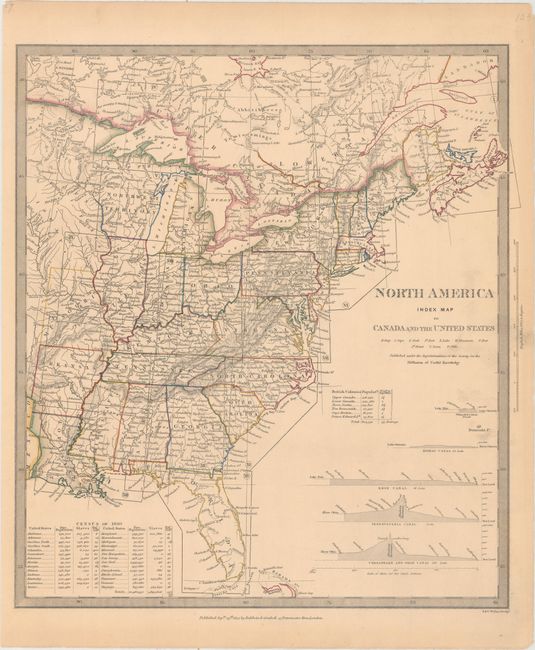
The beginning of the nineteenth century saw a period of rapid market growth and innovation in the map publishing world. Increased literacy and public interest in new frontiers and colonies overwhelmed the market because it was oriented toward the small, affluent market of the previous century. With the intent to fill this void, The Society for the Diffusion of Useful Knowledge (SDUK) was founded in 1828 in London, by Lord Brougham and a group of men dedicated to the education of the aspiring working class and the Utilitarian ideal of 'Knowledge is Power.' The society produced an array of education materials, but the series of maps was one of their most successful ventures. A number of engravers and printers were used to produce the maps, which eventually exceed 200 sheets, and continued to be published after the Society as a whole ceased to function.
This is the index sheet to the SDUK's fourteen sheet map of the eastern United States and Canada. An inset at bottom shows the Census of 1830 in the 28 states composed of the free and slave populations as well as population density. Another inset shows the total population and population per square mile in the British provinces of Canada. Includes elevation profiles of the Welland and Rideau locks in Canada, and the Erie, Pennsylvania and Chesapeake & Ohio canals. Published by Baldwin & Cradock.
References:
Condition: B+
Original outline color with light toning and a bit of printer's ink residue at right.