Subject: Gulf of Mexico & Caribbean
Period: 1802 (dated)
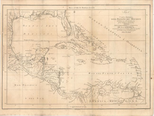
Publication: Descubrimiento y Conquista de la America...
Color: Black & White
Size:
18 x 12.7 inches
45.7 x 32.3 cm
This very rare map was issued in D. Juan Corradi's Descubrimiento y Conquista de la America o Compendio de la Historia General del Nuevo Mundo, published in Madrid in 1803. The map appears to be based upon Thomas Kitchin's Map of the Gulf of Mexico, the Islands and Countries Adjacent, and is slightly smaller. Cartographically, the map covers the region from Florida and the Gulf Coast to northern South America. This updated version shows a fairly accurate southern tip of Florida and is no longer a set of fragmented islands. There is crisp detail of the many islands, the South American coast and Central America. Drawn by Gonzalez and engraved by Morata.
References:
Condition: B+
Issued folding on watermarked paper with light toning and a 2.5" edge tear at top left that has been closed on verso with archival tape.