Subject: Gulf of Mexico, Caribbean & Southern United States
Period: 1682 (circa)
Publication: Atlas Minor
Color: Hand Color
Size:
22.1 x 18.2 inches
56.1 x 46.2 cm
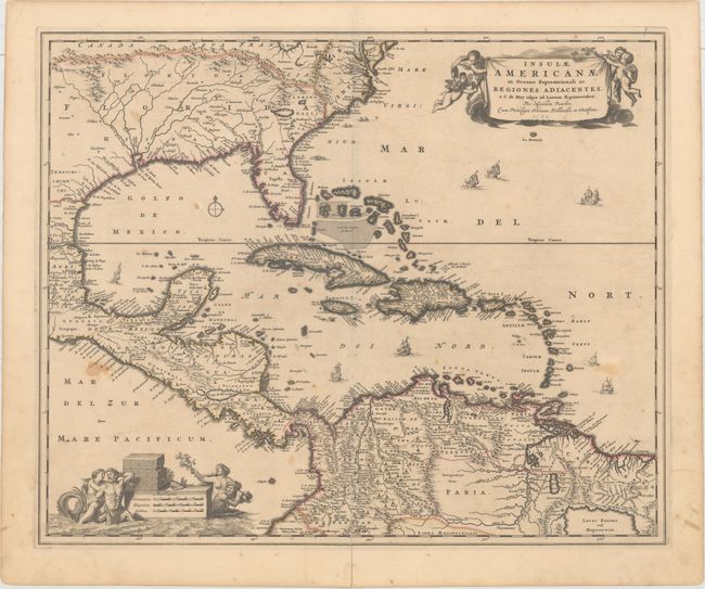
This handsome map focuses on the West Indies and covers the region from the Chesapeake through the Gulf of Mexico, with Central America and the northern part of South America. Two lovely cartouches with cherubs and mermaids decorate opposite corners. Eight ships sail the seas and three native canoes are depicted off the coast of North America. A number of interesting cartographic myths appear on the map. These include two large nonexistent lakes in the region of western Georgia and a non-existent mountain range extending from the Piedmonts bearing across the North American continent. In South America, the archetypal cartographic myth, Manoa o' El Dorado (the golden city), is located on the shores of the Lacus Parime vel Roponowini in Guyana. This is the second state with the addition of the privilege in the cartouche.
References: Burden #531; Portinaro & Knirsch #82.
Condition: B+
Original outline color on watermarked paper with a fold separation at bottom that extends 3.75" into the image that has been archivally repaired on verso. There are several light stains in the image.