Subject: Southwestern United States & Mexico
Period: 1851 (dated)
Publication: Philip's Commercial Atlas of the World
Color: Hand Color
Size:
24.6 x 20.3 inches
62.5 x 51.6 cm
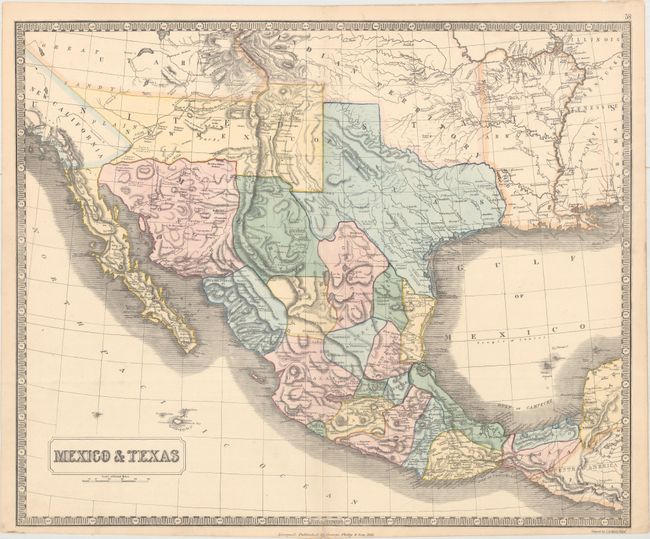
This rare map of the Southwestern United States and Mexico shows the border along the Gila River prior to the Gadsden Purchase, a transaction that occurred the same year as the map was published. The new state of Texas is well-detailed, and California is named as New California. The New Mexico Territory includes what would become Arizona and portions of present-day Nevada. Indian Territory stretches into the region that became Colorado, and Utah Territory sweeps all the way to California. Surrounded by a keyboard style border.
References:
Condition: A
A clean and bright example with original color, some extraneous creasing along the centerfold, and light toning along the edges of the sheet.