Subject: Southwestern United States & Mexico
Period: 1851 (dated)
Publication: Bauerkeller's Handatlas der Allgemeinen Erdkunde
Color: Printed Color
Size:
17.6 x 14.1 inches
44.7 x 35.8 cm
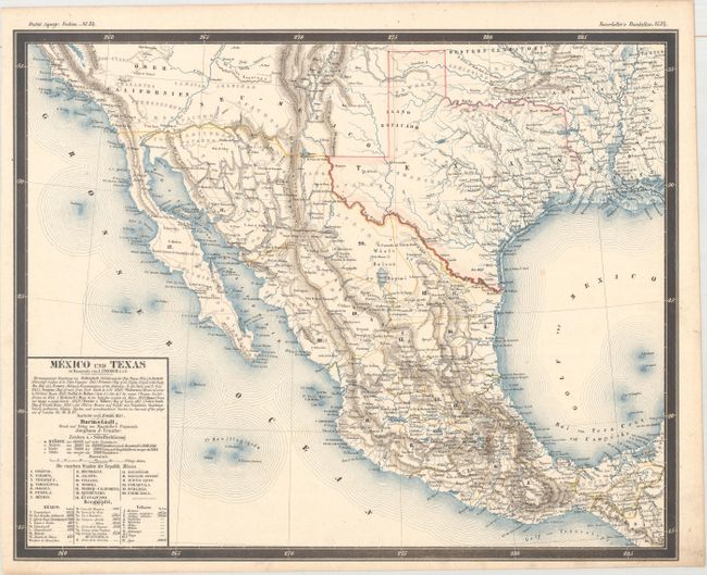
This unique and rare map was published in Georg Leonhart Bauerkeller's Handatlas, a loose-leaf color atlas that began as a subscription in 1844. The maps were printed using multi-color lithography, with elevations in brown and water in blue, and further enhanced with hand coloring to identify boundaries and points of interest. The majority of the maps, including this one, were carefully created by Ludwig Ewald. Ewald used numerous sources in preparing this map, which are noted in the title and include Humboldt, Fremont, Emory, and Disturnell, among others. Below the title is a numbered key to the states in Mexico, as well as a list of the heights of mountains and volcanoes in Mexico. Texas is shown several years after gaining statehood, and is the only US state for which the boundaries are delineated. Oklahoma is labeled Western Territory, while to the west of Texas are Neu-Mexico and Ober-Californien. Numerous Indian tribes are noted throughout the region west of the Mississippi River. A very attractive and uncommon map.
References:
Condition: B+
Original color with a few small spots and very light soiling.