Subject: Southwestern United States & Mexico
Period: 1782 (circa)
Publication:
Color: Black & White
Size:
16.8 x 12.7 inches
42.7 x 32.3 cm
Pierre Marie Francois, Viscomte de Pages (1748-93), a French naval officer, completed a circumnavigation of the world and expeditions towards both the north and south poles between 1771-76. During the beginning of his circumnavigation of the world, Pages sailed to New Orleans and then along the Mississippi and Red Rivers to Natchitoches. Pages then traveled over land across present-day Texas and Mexico by the "Old San Antonio Road." After arriving in Acapulco, Pages continued his journey across the Pacific Ocean. Pages' account of his travels, including two maps, was published in 1782 in Voyages Autour du Monde, et Vers les Deux Poles, par Terre et par Mer... Several other editions were published, including an English translation in 1792-93, however not all of the later editions included the maps.
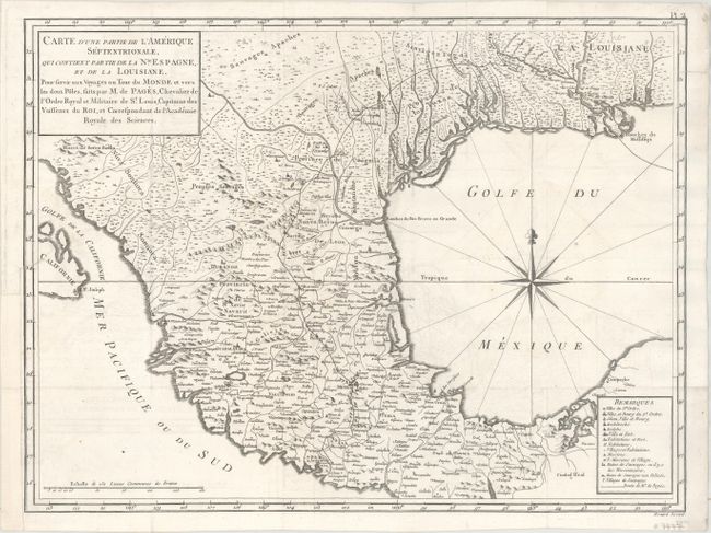
The key map from Pages' account is Carte d'une Partie de l'Amerique Septentrionale, qui Contient Partie de la Nle. Espagne..., which shows Mexico and the southern United States and depicts the route of Pages, from the mouth of the Mississippi River to Acapulco, Mexico. Engraved by Benard, this map represents one of the most detailed depictions of the region at the time. In addition to Pages' route, there is excellent detail of villages, forts, missions, political boundaries, "huts of savages where there are missionaries," and "huts of savages that are not policed." Province de los Texas is labeled, surrounded by Indian lands. A fascinating and very rare map.
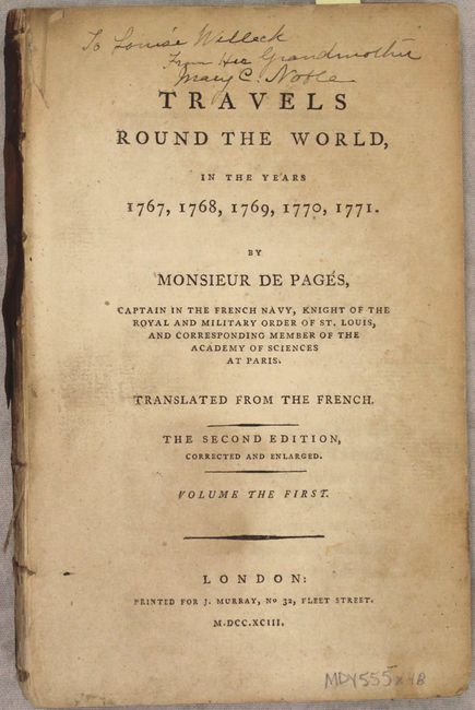
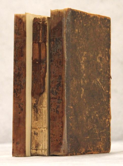
The map is accompanied by the three-volume English translation of Pages' account, which was published in 1792-93. The English translation did not originally include any maps, so the map is likely from an earlier French edition. Three volumes: xx, folding table, 300 pp.; xii, 268 pp.; xxii, 303pp. Condition of volumes: The text of the three volumes is in very good condition, with light toning, occasional soiling, and light damp stains affecting about 70 pages of volume I and 50 pages of volume II. Volumes I and II are disbound, with the text of Volume I beginning to separate. Volume III is hardbound in original leather, with the spine nearly perished and the boards held on with clear tape. The boards are heavily scuffed and worn.
References: Howes #P13; Sabin #58171; Shirley (BL Atlases) G.PAGE-1a #2; Streeter (Texas) #1027.
Condition: B+
The condition code is for the map, which has been professionally conserved. Issued folding, the map is now flattened and backed in thin, archival tissue, with very light offsetting. A 1" binding tear at left, and a tear that just enters the map border at right, have both been professionally repaired. The binding trim at left has been replaced with period correct paper. See description above for the condition of the text volumes.