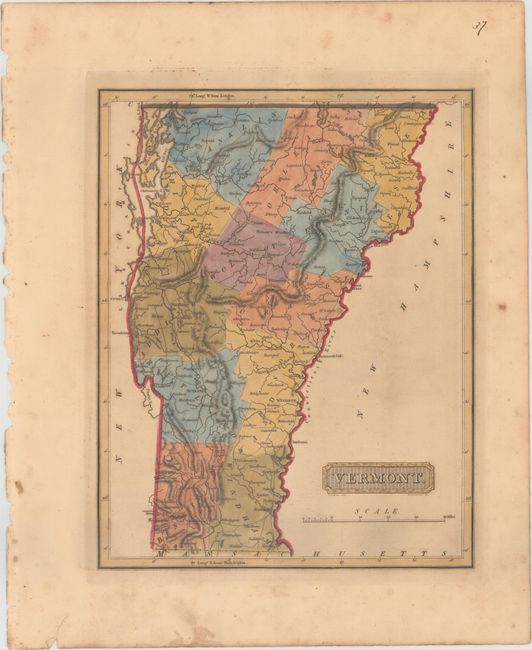
Subject: Vermont
Period: 1816 (circa)
Publication: A New and Elegant General Atlas...
Color: Hand Color
Size:
8.4 x 10.6 inches
21.3 x 26.9 cm
This elegant and uncommon map of Vermont features plenty of towns, roads, and topographical details. County configuration is essentially current, although Jefferson/Washington County is mysteriously called Wolcot (the town of Wollcott is not identified). Dartmouth College is identified by the New Hampshire border. Drawn by Samuel Lewis and engraved by H.S. Tanner. Lucas' General Atlas is known as one of the finest general atlases produced in the U.S. at the time, due to the high quality paper, superior engraving quality, and attractive coloring style.
References: Phillips (Atlases) #3542-37.
Condition: B+
In full original color with light toning and a few spots of foxing.