Subject: New Jersey
Period: 1816 (circa)
Publication: A New and Elegant General Atlas...
Color: Hand Color
Size:
8.1 x 10.4 inches
20.6 x 26.4 cm
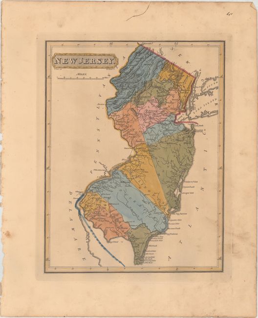
This handsome and uncommon map of New Jersey depicts counties, towns, roads, rivers, and mountains. County configuration is current. New York City and Philadelphia are shown in miniature plan form. A number of inlets, beaches, and harbors are identified along the coasts, especially in the southern part of the state. Drawn by Samuel Lewis and engraved by H.S. Tanner. Lucas' General Atlas is known as one of the finest general atlases produced in the U.S. at the time, due to the high quality paper, superior engraving quality, and attractive coloring style.
References: Phillips (Atlases) #3542-41.
Condition: B+
Full original color with light toning and soiling.