Catalog Archive
Auction 163, Lot 319

"Diagram of the Surveying District South of Tennessee", General Land Office

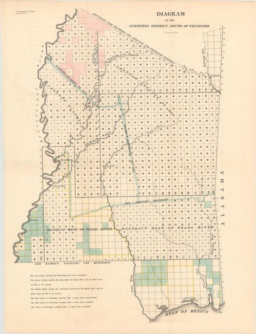
Subject: Mississippi

Period: 1838 (published)

Publication: Sen. Doc. 17 No. 7, 25th Congress, 3rd Session

Color: Hand Color

Size:
11 x 16.1 inches
27.9 x 40.9 cm
Download High Resolution Image
(or just click on image to launch the Zoom viewer)

An uncommon and interesting survey map of the region of present-day Mississippi based on work completed by C.A. Bradford. It presents the official surveying progress throughout Mississippi, utilizing a series of letters and icons with an explanation below the map image. It shows lands ceded by the Choctaw Indians in 1830, as well as the old tribal boundaries of 1822. The northern boundary is labeled Boundary Line Between the Choctaw and Chickasaw Cessions. Only a handful of towns are identified, such as Jackson, Vicksburg, and Columbus.

References: Claussen & Friis #286.

Condition: A

Issued folding with minor toning and faint offsetting.

Estimate: $140 - $170

Unsold

Closed on 6/14/2017

Archived