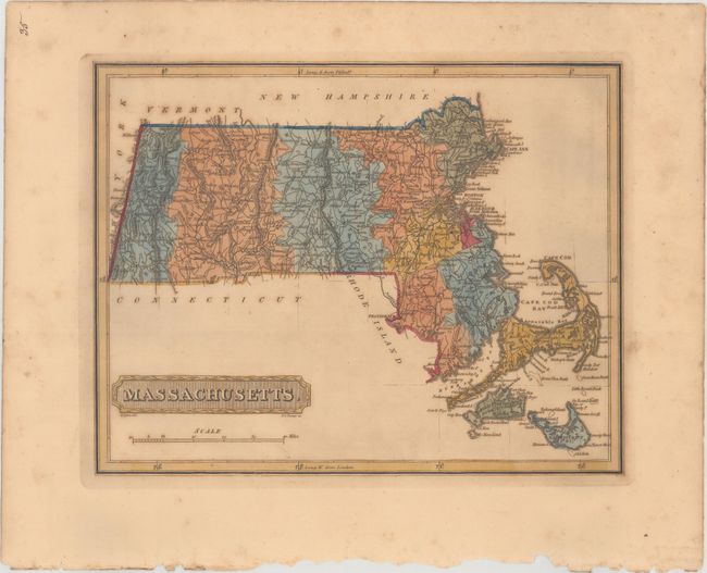
Subject: Massachusetts
Period: 1816 (circa)
Publication: A New and Elegant General Atlas...
Color: Hand Color
Size:
10.8 x 8.4 inches
27.4 x 21.3 cm
This striking and uncommon map of Massachusetts depicts county lines current for 1809, before Franklin County was formed from Hampshire. There is good detail of rivers, mountains, roads, and towns throughout the map. Beaches, harbors, capes, bays, and banks are identified along the coasts, with nice detail around Martha's Vineyard and Nantucket. Drawn by Samuel Lewis and engraved by H.S. Tanner. Lucas' General Atlas is known as one of the finest general atlases produced in the U.S. at the time, due to the high quality paper, superior engraving quality, and attractive coloring style.
References: cf. Phillips (Atlases) #3542.
Condition: B+
Full original color with light toning and scattered foxing.