Catalog Archive
Auction 163, Lot 305

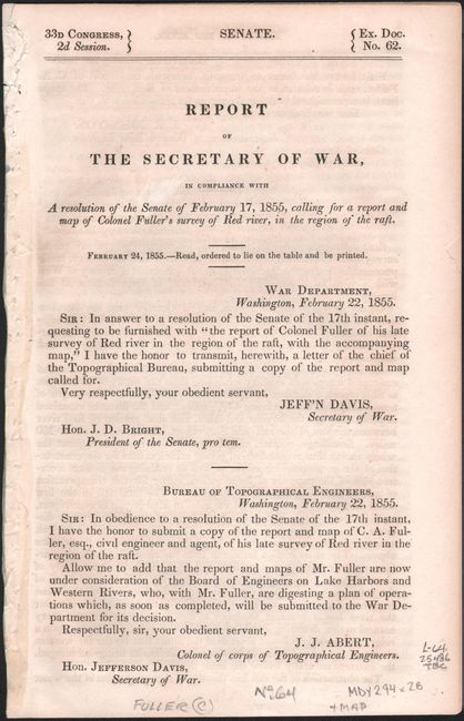
"Map of Red River with Its Bayous and Lakes in the Vicinity of the Raft [with report]", U.S. War Department

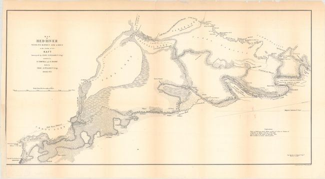
Subject: Northwestern Louisiana

Period: 1855 (published)

Publication: Sen. Ex. Doc. 62, 33rd Congress, 2nd Session

Color: Black & White

Size:
23.6 x 12 inches
59.9 x 30.5 cm
Download High Resolution Image
(or just click on image to launch the Zoom viewer)

This map shows soundings in the Red River from Shreveport to its confluence with Red Bayou. The 13-mile length of the river is marked and tributaries, topography, and adjacent lakes are indicated. Dutch Johns, Marks, Soda and Shiftail lakes are located. Ownership of numerous land holdings are also noted on this detailed chart. The map is accompanied by a 6-page report from the Secretary of War regarding Colonel Fuller's survey of the Red River.

References:

Condition: B+

Issued folding with light toning along the folds, a couple of short separations along the folds that have been archivally repaired on verso, and a binding trim at left that has been replaced with old paper, with some loss of the neatline.

Estimate: $140 - $170

Sold for: $100

Closed on 6/14/2017

Archived