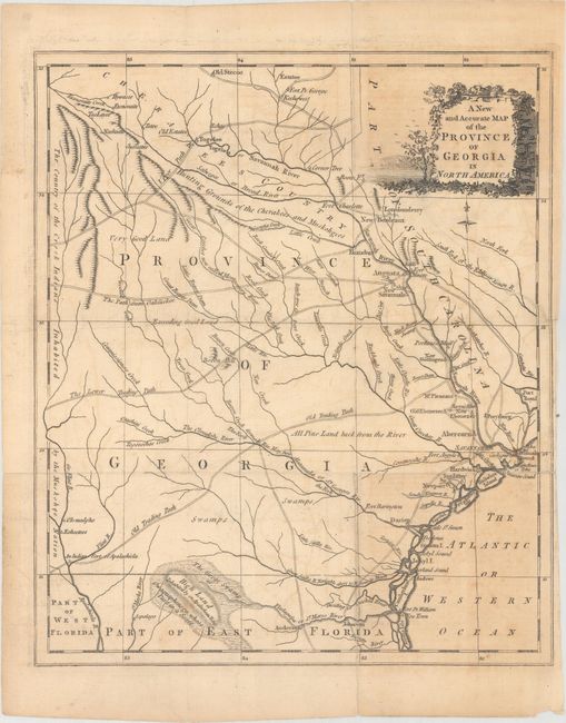
Subject: Georgia
Period: 1779 (published)
Publication: Universal Magazine
Color: Black & White
Size:
10.8 x 12.7 inches
27.4 x 32.3 cm
This scarce map is one of the earliest maps to focus strictly on Georgia. It provides an excellent view of the colony showing most settlement along the Savannah River or the Atlantic coastline. The interior is filled with detail of the Indian villages and territory, trading paths, trails, forts, rivers, swamps and creeks. There are also several interesting notations such as "Owaquaphenoga, whose pass is a Secret" and "Hunting Grounds of the Cherakees and Muskohgees."
References: Jolly #UNIV-179; Sellers & Van Ee #1569.
Condition: B
Issued folding on watermarked paper with light offsetting, some toning at top right and bottom right, and a few minor extraneous creases. A 4" binding tear at right and a short fold separation also at right have both been archivally repaired.