Subject: Central Florida
Period: 1837 (circa)
Publication:
Color: Black & White
Size:
10.8 x 14.9 inches
27.4 x 37.8 cm
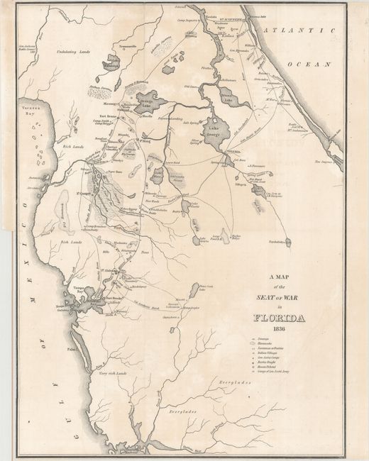
A. A Map of the Seat of War in Florida (10.8 x 14.9"). This is the first map by Major Gen. W. Scott to show the progress of the Seminole Wars. The map shows much of northern Florida from Charlotte Harbor in the southwest to St. Augustine in the northeast. Locates Tampa Bay, Lake George, Drums Lake, and numerous forts including Drane, Izard, Cooper, Alabama and Brooke. Delineates the routes of Gen. Eustis, Col. Goodwin, plus the Military Road from Fort Brooke to Fort King. Locates swamps, fords, numerous small settlements and a few battle sites. Many interesting place names like Negro Town, located northeast of Fort Cooper on the edge of the Great Swamp or the Cove of the Ouithlacoochee. Condition: Light offsetting and minor, uneven toning. Trimmed to the neatline at top and bottom.
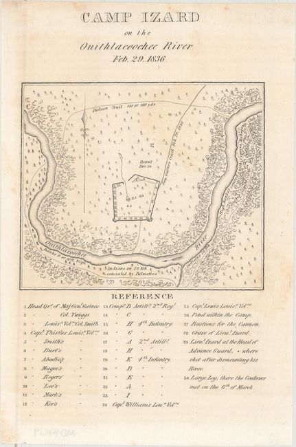
B. Camp Izard on the Ouithlacoochee River Feb. 29. 1836 (4.7 x 4"). This small map shows the fort and locations of Indians on February 28 and 29, 1836. The fort was "Burnt Dec. 29." The map locates the "Indians on 28 Feb. concealed by Palmettos." The legend identifies troop headquarters and positions, the location of Lieut. Izard's grave, and more. Condition: Light scattered foxing.
References: Claussen & Friis #152 & #153.
Condition: B+
See description above.