Catalog Archive
Auction 163, Lot 269

Large Format Map of the State

"Sectional Map of Florida", Matthews-Northrup Co
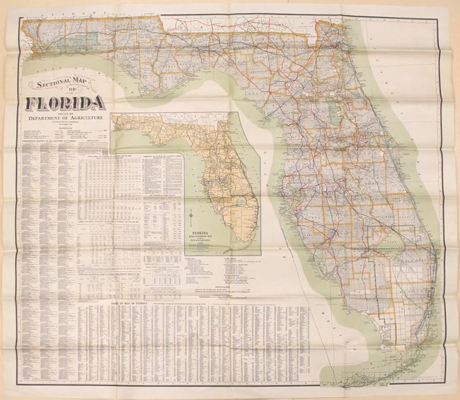
Subject: Florida

Period: 1925 (dated)

Publication:

Color: Printed Color

Size:
47.2 x 42.7 inches
119.9 x 108.5 cm
Download High Resolution Image
(or just click on image to launch the Zoom viewer)

This very large folding map is delineated by county and colorfully illustrates the railroad network in the state. Surveying is nearly complete, but pockets of Broward and Monroe counties are still undeveloped. The sheet also contains a large inset map showing the growing road network in the state. The remainder of the sheet contains related text on county statistics, population, and farming as well as an index. Published by the Florida Department of Agriculture under the direction of Nathan Mayo and lithographed by Matthews-Northrup.

References:

Condition: A

A clean, colorful example. Issued folding.

Estimate: $140 - $170

Sold for: $100

Closed on 6/14/2017

Archived