Subject: Florida, Cuba, Bahamas
Period: 1852 (dated)
Publication:
Color: Black & White
Size:
50.2 x 38.2 inches
127.5 x 97 cm
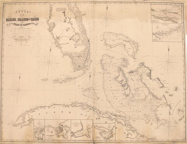
This impressive, large-scale blueback chart consists of two joined sheets and covers the southern half of Florida, northern Cuba, and the Bahamas. It is filled with an incredible amount of navigational information including soundings, reefs, rocks, and shoals, as well as navigational routes, currents and extensive notations. A few lighthouses are marked with yellow and red, as is typical on Imray charts. The chart is augmented by a series of insets including Nassau Harbor, Havana Harbor, and Matanzas to name a few. Published by James Imray & Son at 102 Minories in London. Originally issued in 1852 with additions to 1854.
References:
Condition: B
There is light dampstaining at the top of the image along the border and scattered foxing along the bottom border and the joint. The joint is separating just a bit at bottom and there is a short edge tear at top that extends 2" into the image.