Subject: Florida
Period: 1846 (dated)
Publication: A New Universal Atlas...
Color: Hand Color
Size:
11.7 x 14.6 inches
29.7 x 37.1 cm
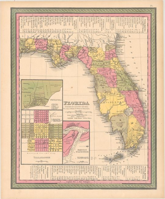
This is a revised edition of Tanner's map of Florida showing towns, railroads, forts, roads, canals, major rivers, and lakes. There are references to forts, battlefields, and routes used by the Army during the Seminole War. There are also three inset maps detailing Pensacola, Tallahassee, and St. Augustine. County configurations are current to the publication date, with Mosquito renamed to Orange County and the creation of Levy County along the Gulf Coast. Water routes from St. Augustine and Pensacola to various ports are described along the upper and lower margins. Printed by H.N. Burroughs.
References:
Condition: A
Original color with one small spot and light toning along sheet edges.