Subject: Delaware
Period: 1816 (circa)
Publication: A New and Elegant General Atlas...
Color: Hand Color
Size:
8.4 x 10.7 inches
21.3 x 27.2 cm
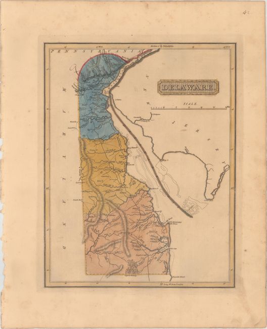
This uncommon map of Delaware includes wagon roads, towns, rivers, and mountains. The state is divided into its three counties: Newcastle, Kent, and Sussex. Shoals are outlined in Delaware Bay. The Great Cypress Swamp is identified in the southern part of the state. Drawn by Samuel Lewis and engraved by H.S. Tanner. Lucas' General Atlas is known as one of the finest general atlases produced in the U.S. at the time, due to the high quality paper, superior engraving quality, and attractive coloring style.
References: Phillips (Atlases) #3542-43.
Condition: B+
In full original color with light toning and soiling and minor scattered foxing mostly confined to the blank margins.