Subject: Arkansas
Period: 1866 (dated)
Publication: Maps Accompanying the Report of the Commissioner of the General Land Office...
Color: Hand Color
Size:
20.3 x 15.9 inches
51.6 x 40.4 cm
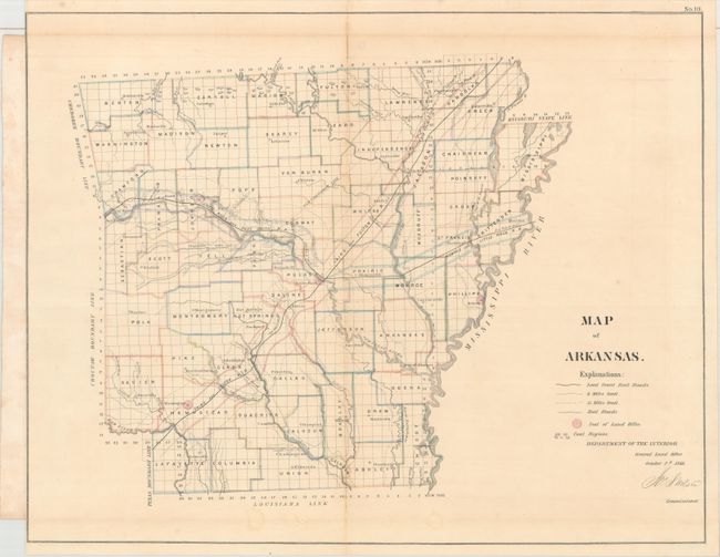
From the first year that large, colored, linen-backed state maps were issued by the GLO. This map of the state shows counties, railroad land grants, coal deposits, and towns. The western border joins with the Cherokee and Choctaw Boundary lines. The map details the Cairo and Fulton R.R. and its land grants 6 and 15 mile limits. No indication of any survey progress. Signed in the plate by the GLO Commissioner Jos. S. Wilson.
References: Phillips (Atlases) #1388-10.
Condition: B+
Issued folding and backed in linen as issued. There is light toning along the folds, a short fold separation at top, and binding trims close to neatline at left-hand corners.