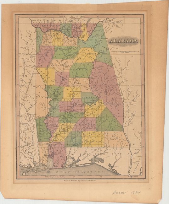
Subject: Alabama
Period: 1824 (circa)
Publication: A New General Atlas...
Color: Hand Color
Size:
8.9 x 11.3 inches
22.6 x 28.7 cm
A fine, early map of the state of Alabama showing county development and detailing the wagon roads, settlements, and river systems. County configurations are current to 1822, with Walker County not yet appearing in the northern portion of the state (1823), Indian lands are shown, with the area to the west labeled Choctaws Land and to the east is Upper Creeks and Lower Creeks, with the Creek lands surrounded by Fort Decatur, Fort Williams, and Fort Strother. The map extends south to include West Florida. Lucas' General Atlas is known as one of the finest general atlases produced in the U.S. at the time, due to the high quality paper, superior engraving quality, and attractive coloring style. Engraved by J. Cone.
References: Phillips (Atlases) #742-69.
Condition: B
Light to moderate toning that is more prominent in the blank margins.