Subject: Southwestern United States
Period: 1915 (published)
Publication: The Official Correspondence of James S. Calhoun...
Color: Black & White
Size:
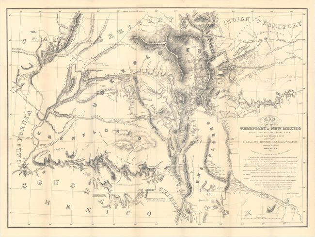
33 x 24.3 inches
83.8 x 61.7 cm
This is a later edition of this rare and important map of the Territory of New Mexico stretching from Pike's Peak to Cooke's Wagon Road in Sonora. Originally published in 1852, the map was distributed to officers in the region and those who requested it, but it never appeared in a report, making the original essentially unobtainable. Compiled by Lt. John G. Parke and drawn by Richard H. Kern, it shows the region in the years immediately following the Mexican-American War, when many boundary disputes were still ongoing and large swaths of land were unexplored. It replaced Abert's map as the primary cartographic source for the region. Richly detailed, it extends to show parts of Texas, Indian Territory, Utah Territory, California, and parts of Mexico.
References: Howes #C28; cf. Wheat (TMW) #730.
Condition: A
A crisp sheet with very minor toning.