Subject: Western United States
Period: 1885 (dated)
Publication:
Color: Hand Color
Size:
33.6 x 22.6 inches
85.3 x 57.4 cm
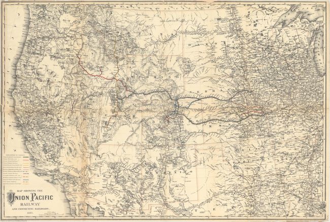
This uncommon map demonstrates the expanding Union Pacific Railway in the western United States. Consolidated main lines from Omaha to Ogden and Kansas City through Denver are colored in gray. The map's color-coded key also identifies a variety of connecting railways including the Oregon Short Line and Kansas Central, the Central Branch Union Pacific,the Colorado Central, the Utah Central, and many more. The map is a testament to Colton's attention to detail and accuracy in that it includes scores of obscure little mining towns while leaving unknown areas blank, such as south-central Utah. Prepared by G.W. and C.B. Colton and printed by William Mann & Son Stationers & Printers.
References:
Condition: B+
Issued folding and now flattened and professionally backed with tissue. Several small fold separations and a 1.25" binding tear at left have been repaired with archival materials on verso. Trimmed close to the neatline at top, bottom, and left.