Subject: Western United States
Period: 1814 (circa)
Publication: Carey's General Atlas
Color: Hand Color
Size:
13.9 x 12.1 inches
35.3 x 30.7 cm
Mathew Carey was a seminal figure in early American publishing; establishing the first publishing firm to specialize in cartography and issuing the first atlas devoted exclusively to American maps. He set up an elaborate cottage system of craftsmen for compiling, engraving, printing, and coloring maps. This practice was emulated by later American cartographic publishers such as John Melish and Henry S. Tanner. The American Atlas concept was also adopted by other publishers in both the United States and Europe.
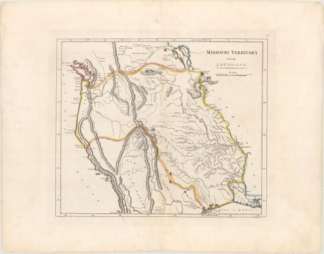
This is one of the earliest printed maps of Missouri Territory, which was organized in 1812. It was published in the same year as Lewis & Clark's foundation map, and incorporates many of the new discoveries from that expedition along the Upper Missouri and Columbia rivers. The map notes a "probable" northern boundary from Puget Sound to Lake of the Woods, and a "probable" southern boundary extending from San Francisco Bay to the headwaters of the Rio Grande and then southeast to Galveston Bay. Carey issued a pocket version of this map in the same year, and while it contains the same geography, this larger version includes much more detail in terms of topography and river systems. Drawn by Samuel Lewis engraved by John Bower.
References: Wheat (TMW) #315.
Condition: A
Original outline color with faint toning along the centerfold and centerfold separations confined to the top and bottom blank margin that have been closed on verso with archival material.