Subject: Upper Midwestern United States
Period: 1855 (dated)
Publication: Atlas of the World
Color: Hand Color
Size:
16.2 x 13 inches
41.1 x 33 cm
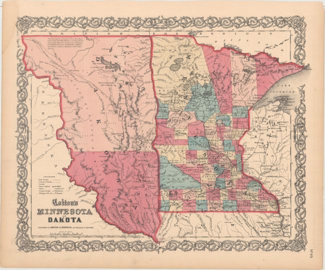
The newly formed Dakota Territory is a huge unorganized area with the Missouri River as its western boundary. An interesting notation locates vast prairies said to be "the great Hunting and Fighting Ground of Kdackotah, Odjibwe, Assiniboin, Arikara, Minitarree and other Nations." There is good detail throughout a Minnesota in the midst of many changes just a couple years before its statehood. County configuration is current to 1856, with the addition of new counties Meeker, McLeod, Morrison, Sherburne, Pine, and St. Louis. A handsome map with Colton's decorative scroll border. Published by Johnson and Browning, 1859-61.
References:
Condition: A
Minor toning with a light damp stain that just touches the border at top left.