Subject: Central United States
Period: 1833 (dated)
Publication:
Color: Hand Color
Size:
15.6 x 12.3 inches
39.6 x 31.2 cm
The beginning of the nineteenth century saw a period of rapid market growth and innovation in the map publishing world. Increased literacy and public interest in new frontiers and colonies overwhelmed the market because it was oriented toward the small, affluent market of the previous century. With the intent to fill this void, The Society for the Diffusion of Useful Knowledge (SDUK) was founded in 1828 in London, by Lord Brougham and a group of men dedicated to the education of the aspiring working class and the Utilitarian ideal of 'Knowledge is Power.' The society produced an array of education materials, but the series of maps was one of their most successful ventures. A number of engravers and printers were used to produce the maps, which eventually exceed 200 sheets, and continued to be published after the Society as a whole ceased to function.
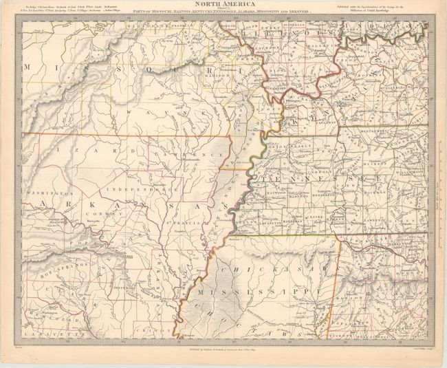
A detailed map of the Mississippi River and Ohio River valleys. Spans from the Osage River in Missouri east to Rome, Indiana in the north and from the Red River in Arkansas to Elyton, Alabama in the south. Northern Mississippi is identified as lands of the Chickasaw and Choctaw tribes. A great map showing the extent of western emigration at this early point in U.S. history.
References:
Condition: A
Original outline color with a few tiny edge tears confined to the right blank margin that have been closed on verso with archival tape.