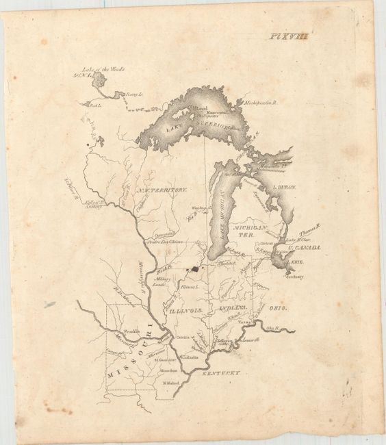
Subject: Central United States
Period: 1822 (published)
Publication: A Geography for Schools...
Color: Black & White
Size:
6 x 8.1 inches
15.2 x 20.6 cm
This map was issued in Luke Drury's scarce A Geography for Schools, upon a Plan Entirely New, Consisting of an Analytical Arrangement of All the Great Features of Nature, Particularly Adapted to an Atlas of Forty Luminous and Concise Maps.... It depicts the region to the north of the Ohio River and east of the Mississippi River, including Ohio, Indiana, Illinois, Michigan Territory, and Northwest Territory. The map shows the larger river systems and a handful of settlements, including Detroit and Ft. Malden in Canada. Military Lands associated with payment for service in the War of 1812 are located in Western Illinois, and the spurious Phillipeaux Island still persists in Lake Superior.
References: Phillips (Atlases) #279.
Condition: B
There is light offsetting, scattered foxing, and a small ink spot at center.